Here are some guidelines for a trouble-free and enjoyable trip through the New Jersey ICW:
Don’t follow the magenta line or the buoys on your chartplotter – they are merely general guides. If you do follow the magenta line or the buoys on your chartplotter, you will definitely go aground.
Do follow the buoys and day markers you see in front of you – they mark the best water. In areas where buoys are used, they are often moved, and additional ones are added as necessary. Follow the numbers and colors. For example: if your chart shows three green buoys in a line, but you observe that one is way off to one side, it is most likely there for a reason. It is also a wise idea before even starting out on the NJICW to call the Coast Guard or TOWBOATUS ahead of time and ask if there are any markers that are off- station, or if they know of any recent shoaling.
Don’t cut corners.
Don’t pass buoys or day markers on the wrong side.
Do stay in the middle of the channel except when passing other boats. If your depths are looking shallow, look behind your boat at the last mark you have passed, and make sure that you are in the middle of the channel.
Avoid traveling the Waterway on weekends or holidays. New Jersey is the most densely populated state in the U. S., so it is not surprising that it also has the greatest boating density in the country. The boat traffic on weekends can be considerable, and it is highly likely that you will find yourself being passed very closely by vessels traveling at high speeds with little regard for fellow boaters. As “locals” who live just off the NJICW, take our advice, weekdays are much better for travel!
Don’t let the charted depths north of the Route 37 Bridge in Barnegat Bay scare you. There is more water in the channel than the chart shows.
The last bridge on the New Jersey ICW heading north is a railroad bridge which crosses the Manasquan River. Use caution when transiting this area, as it can be congested with boats. The opening at the bridge is narrow, and the current can run strong. Before entering the bridge, be sure that you have a clear view through the bridge.
If you draw 4 feet of water or less, you should be fine traveling the NJICW. However, we suggest that you travel between mid and high tide to ensure plenty of water below your keel. If your draft is over 4 feet, you may want to take the ocean route!
The majority of the bottom on the NJICW is soft mud, so if you are going slowly and find yourself touching the bottom, you can usually get yourself off with little problem.
The above is an excerpt from our new book, “The Great Loop Experience from Concept to Completion (A Practical Guide for Planning, Preparing, and Executing Your Great Loop Adventure)”, which will be available this fall.
We traveled the NJICW from Atlantic City to our home off Barnegat Bay aboard our boat, Reflection, which has a draft of 4 feet on May 27. We left Atlantic City at mid tide rising and had no problems traveling this waterway, which we have done for over forty years!
Stay safe out there.
George and Pat Hospodar, authors of “Reflection on America’s Great Loop” published by Atlantic Publishing.
Fort Lauderdale, FL- Curtis Stokes and Associates will display and speak at the Albemarle Loop Event April 30th, 2024. More Albemarle Loop Event Info
Fort Lauderdale, FL- Curtis Stokes and Associates will display at the 2024 Oriental Boat Show April 12-14, 2024. More 2024 Albemarle Loop Event
Latest CSA Listings
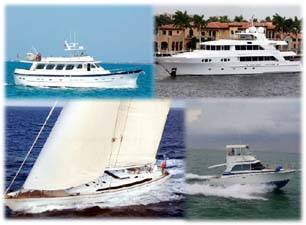
See the latest exclusive listings from Curtis Stokes and Associates. All the newest motor yacht, trawler, sailboat and sportfish boats listings. See the Latest Listings
Curtis Stokes and Associates is a professional, successful, licensed & bonded yacht brokerage firm. With brokers based throughout the United States and Europe, Curtis Stokes & Associates specializes and excels in worldwide yacht sales, yacht charters, and new yacht construction. The firm was launched in September 2009 by Curtis Stokes after he spent many years as a megayacht captain, sales manager at Hatteras Yachts and as a successful broker with the Sacks Group Yachting Professionals. Now, Curtis Stokes and his team of associate brokers travel extensively representing a select group of buyers and sellers worldwide.
FLORIDA
1323 SE 17th Street Suite 168
Ft Lauderdale, FL 33316
855.266.5676
MARYLAND
400 South Talbot Street
Mail: PO Box 190
Saint Michaels, MD 21663
855.266.5676
VIRGINIA
Deltaville Boatyard
274 Bucks View Ln
Deltaville, VA 23043
855.266.5676
WASHINGTON
3001 R Avenue
Anacortes, WA 98221
98221-4602
855.266.5676
CALIFORNIA
1016 Lincoln Boulevard
Suite 222
San Francisco, CA 94129
855.266.5676


 The above is an excerpt from our new book, “The Great Loop Experience from Concept to Completion (A Practical Guide for Planning, Preparing, and Executing Your Great Loop Adventure)”, which will be available this fall.