Call Us: 855.266.5676 | 954.684.0218
Email Us: info@curtisstokes.net 
Call Us: 855.266.5676 | 954.684.0218
Email Us: info@curtisstokes.net 
by Jim Healy

There is little to nothing to attract the cruising and destination interests of cruisers on the Delaware Bay. Cruisers must review the weather forecast carefully before transiting the Delaware Bay in either direction! This large, open, exposed body of water lies geographically Southeast to Northwest. Because of the combined tidal and river flow, ebb currents are 2+ kts, and flood currents are 1-1/2 kts. Ebbs also last longer than floods. Winds from the Southeast or Northwest create steep, short period, choppy sea states on the Delaware Bay, ESPECIALLY when tidal flow is against the winds. There is no place to run for cover along the Delaware Bay. It’s a fine ride in settled weather, so don’t misunderstand. Just be prudent in this stretch! If the marine forecast is at all questionable, we strongly recommend cruisers just stay in port.
Check Skipper Bob for timing your departure for the transit between Chesapeake City, MD and Cape May, NJ. In either direction, If timed right, cruisers can enjoy swift, favorable currents the entire way through the Delaware Bay.
On the northern end of the Delaware Bay, about 1/2 mile north of the Eastern entrance of the C&D Canal, is Delaware City. There is a fine small marina, the Delaware City Marina. Contact the marina on VFH16 for local knowledge getting in. DCM offers gas and diesel fuel, pumpout, floating docks, electric and water, clean showers and small laundry. They have a well stocked ship’s store, an operating boatyard and repair facility, and can haul a boat if necessary. Delaware City is a small town, walkable from Delaware City Marina. There is a small groceria for common food needs, but probably not a major re-provisioning. There are two pub-food restaurants. Lewinsky’s-On-Clinton is burgers and hot sandwiches, and Crabby Dick’s specializes in seafood. This is an excellent, friendly place to wait out bad weather.
Cohansey River, Delaware Bay
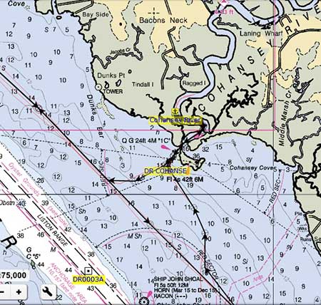
Sanctuary and crew have anchored in the Cohansey River on several occasions. There is no safe cover between Cape May and the Salem River other than the Cohansey River. The Cohansey is on the north shore of the Delaware Bay, in Greenwich, NJ. It is just southeast of the area where the Delaware Bay narrows into the Delaware River.
The character of the Cohansey varies greatly. At the Bay entrance to the Cohansey, the river is shallow salt marsh. The river becomes more wooded as one travels up stream. The better anchoring (water depth, swing room) is in the salt marsh area. The inland section gets very deep – 35ft to 65 ft – with fast running currents, so finding a place with swing room is more challenging. The area is abundant with green-heads (horse flies) in the summer months. There is a fleet of fishing boats from Greenwich that go out between 04h30 and 05h00 most days. They will wake (and waken) cruisers. There are Harbors-of-Refuge at Cape Henlopen/Lewes, DE, and at Cape May, NJ. In my opinion, the anchorage at Ready Island is useful only in settled weather conditions.
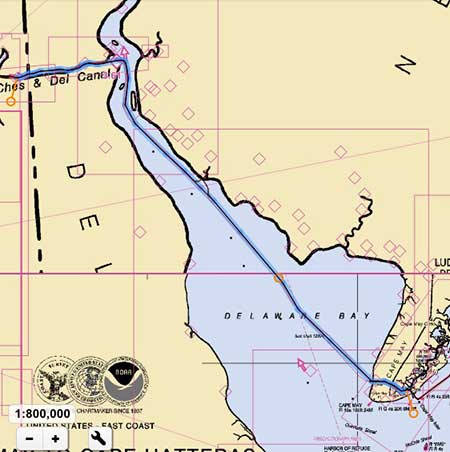
Delaware Bay Route
Sanctuary typically transits the Delaware Bay along a rhumb line from the Cape May Canal to the Salem Nuclear Plant.
By Jim Healy from his Blog Travels of the Monk 36 Trawler, Sanctuary
Disclaimer: Curtis Stokes and Associates does not necessarily agree or promote the content by the above author. This content is to be used only with the reader’s discretion.

© 2024 Curtis Stokes & Associates, Inc. | All rights reserved.